Route Discovery
This was the third walk in my Short Walks Made Easy series and, geographically, the next logical stop as I continued working my way south. Lyndhurst was a name I knew, and I knew it sat in the New Forest, but beyond possibly driving through some years ago, I had never actually stopped and explored the surrounding landscape on foot.
The route came directly from the OS Short Walks Made Easy guidebook, and there were two things that had already caught my attention before I arrived. The first was trig point TP0744. If a route passes reasonably close to a trig point, there is always a good chance I am going to make a point of finding it, so that was already marked as one of the stops along the way.
The second was rather more intriguing. While looking through the route in the guidebook, I had noticed a feature referred to as Dark Dale. When I compared the route with my OS Explorer mapping, however, I found Park Pale marked in the same general area. That immediately gave me something else to look out for. A little searching beforehand suggested that a park pale could survive as an earthwork or raised bank, but looking at photographs online and finding one in a forest are two rather different things. I had no idea how substantial it would be, or whether there would be much left to see at all.
Beyond those points, the landscape itself was part of the attraction. The map suggested a mixture of deep woodland and open heath, which sounded like a good combination for another New Forest exploration.
Preparation & Route Planning
Although I had never walked any part of the route before, I had studied it fairly closely. My main navigation would be the OS Maps app, where I had scanned the route QR code from the book, bookmarked the route and downloaded it ready for offline use. With an existing route already available in the app, there was no need to start transferring GPX files or rebuilding something that was already there.
As a backup, I printed an A4 section of the OS Explorer map covering the walk, laminated it and marked the route using a Lumocolor permanent marker. I have found this preparation useful for more than simply producing a paper backup. Copying a route onto a map forces me to slow down and actually look at what I will be walking through: the type of tracks, contours, junctions and features that might otherwise be skimmed over on a screen. It was during that process that the Park Pale caught my attention.
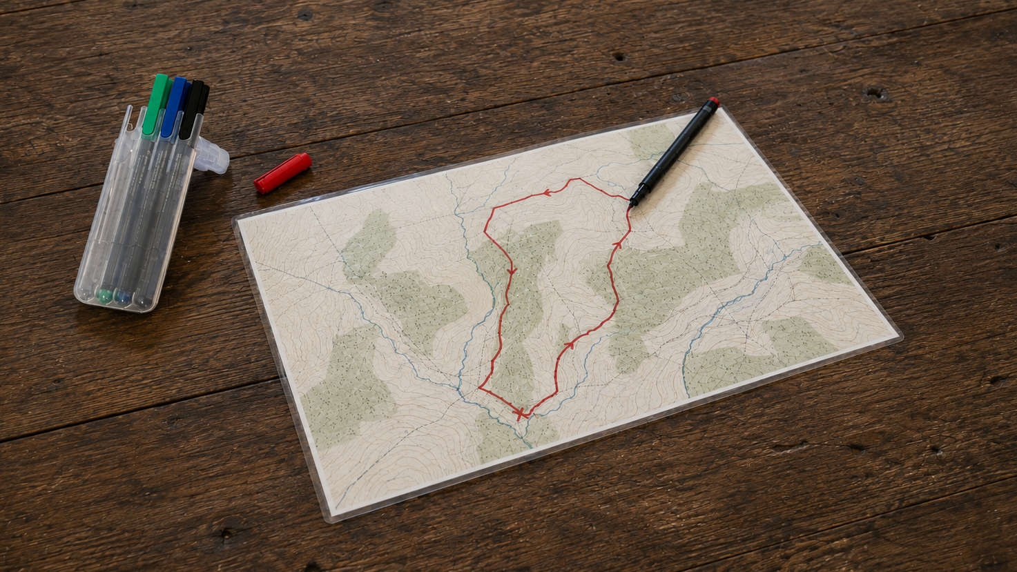
The walk would begin and end at Bolton’s Bench Forestry England car park. As usual, I saved the location in Google Maps and checked Street View beforehand to get a rough idea of the entrance, layout and number of parking spaces. The weather required very little thought. The UK had been experiencing several weeks of consistently warm, dry weather and the forecast suggested more of the same, so I was expecting dry gravel tracks, forest paths and the sandy ground that is common across the New Forest heathland. With an approximately 11am start in August, daylight was hardly going to be a problem either, so clothing was simple: lightweight shorts, a T-shirt and walking shoes.
For navigation I carried my phone running OS Maps, the laminated paper map and a compass as backup. I also filled my water bladder with the full three litres. That was deliberately more water than I expected to need, partly because I had no intention of running short and partly because carrying the additional weight was useful practice.
The map suggested a pleasing combination of open heath and woodland. OS mapping can give a broad indication of whether woodland is coniferous or non-coniferous, but that never quite tells you what a forest will feel like once you are actually inside it. How dense would it be? How much light would reach the forest floor? Would the woodland feel uniform or constantly change? That was part of what I wanted to find out.
Trail Notes
The New Forest atmosphere begins almost as soon as you arrive at the car park, but the walk does not take long to make a much bigger impression. Within the first few hundred metres, the landscape opens into a broad view across White Moor.
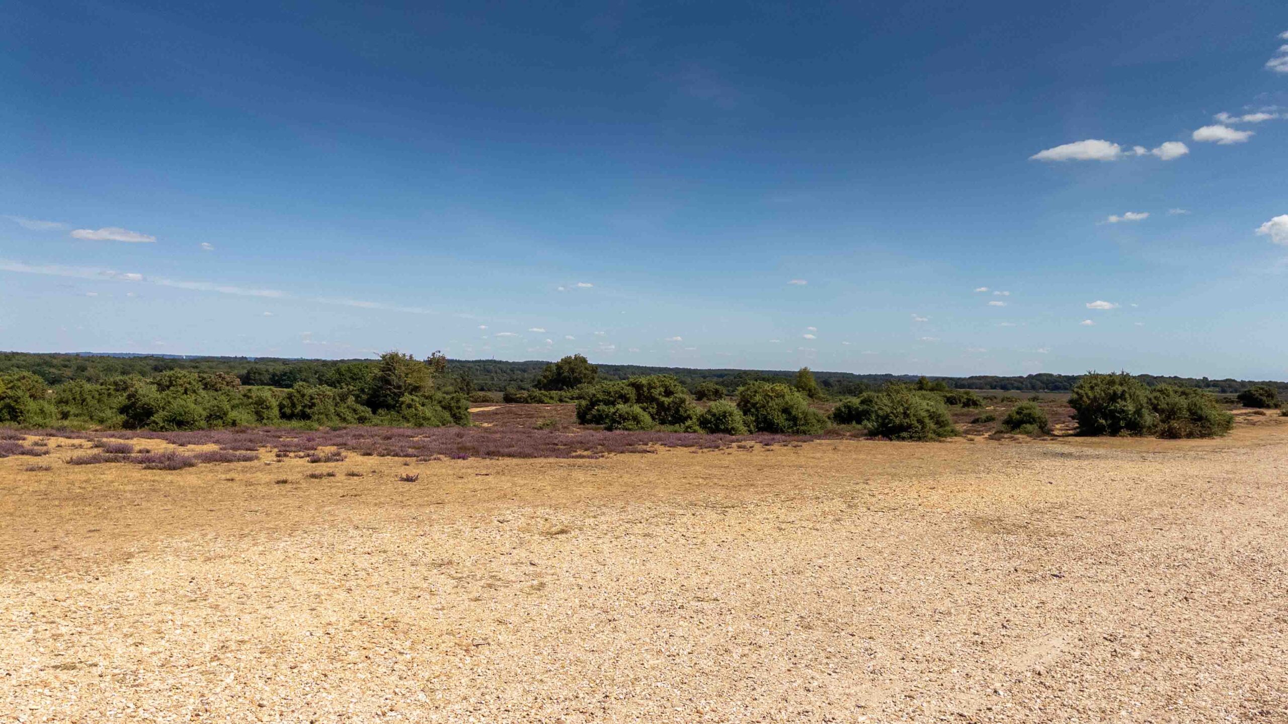
With sunshine, a clear blue sky and excellent visibility, it was a strong start. The surface underfoot shifted between light gravel, sandy heathland and occasional grassy patches, while the openness of the moor immediately contrasted with the forest that would come later. There is one early navigation point worth paying attention to: the route curves away to the right and heads south, while the view naturally pulls your attention north-east across the heath. It would be quite easy to keep admiring the scenery and walk past the turn if you were not occasionally checking the map.
Once away from White Moor, the route enters Pondhead Inclosure, and the character of the walk changes quickly. The wide horizon disappears behind the trees and the route begins to feel properly enclosed. On a sunny day the woodland worked particularly well, with tall trunks standing sharply against patches of blue sky and dappled sunlight breaking through the canopy.
From there the route eventually joins the long line of Beechen Lane. There is something satisfying about these long forest tracks. They pull the eye forward, sometimes disappearing into the trees and sometimes leading toward a brighter opening ahead. Those transitions became one of the recurring pleasures of the walk: a path appearing to go on indefinitely before the woodland suddenly thins and the view changes again.
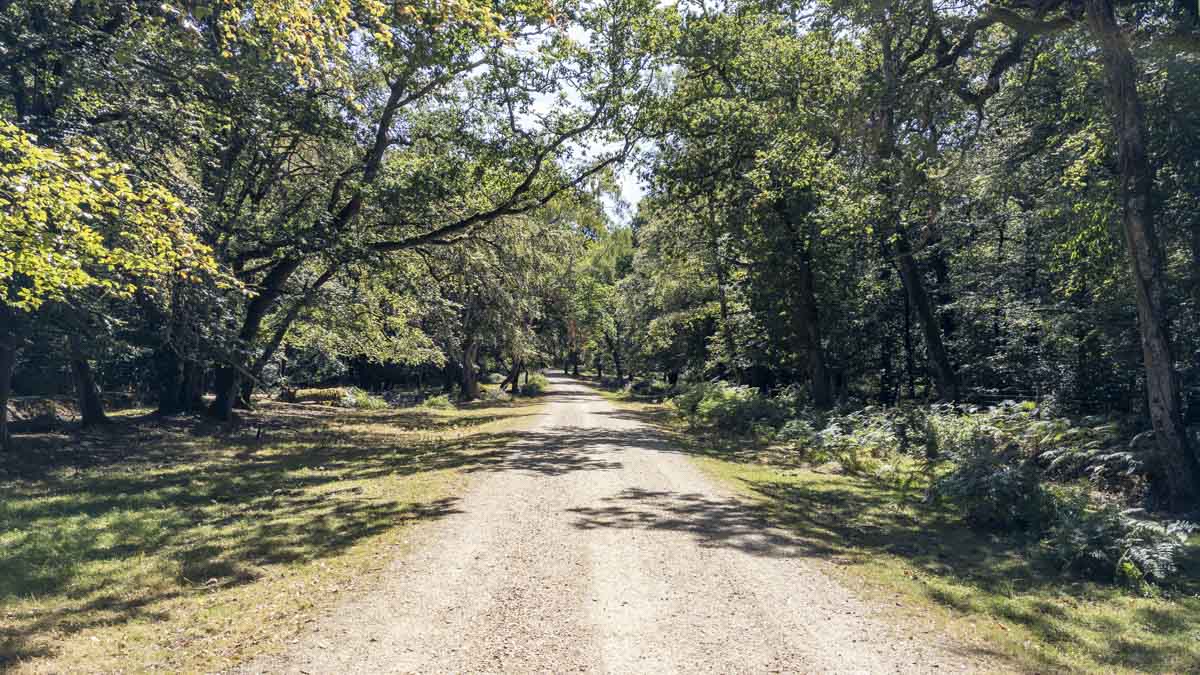
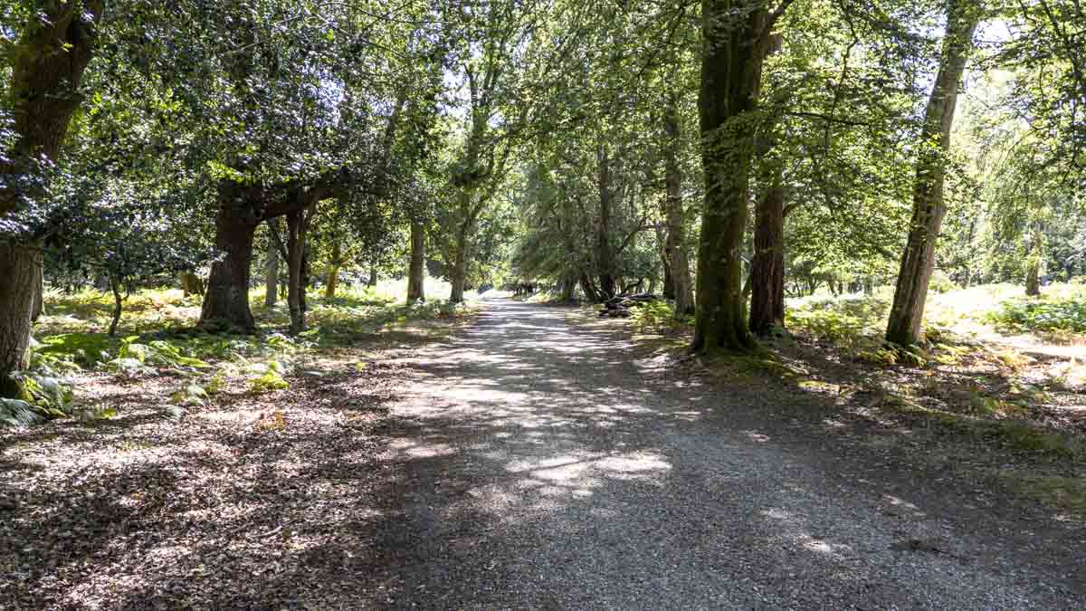
Beechen Lane was also where I began looking more carefully for the first indication of a Park Pale. On the map, the historic feature appeared distinct enough to be worth watching out for, but on the ground there was very little that I could confidently identify. Whatever survives there blends easily into the surrounding forest floor.
Further on, around Park Hill and Denny Inclosure, the woodland began to take on a more coniferous character. It was another subtle change, but enough to keep the forest from feeling repetitive. Then came a second opportunity to look for an elusive Park Pale, and this time there was something much more convincing: a distinctive linear earth mound running through the woodland.
After seeing it only as a symbol and label on a map, finally standing beside something that appeared to match the feature gave the walk one of its most satisfying little discoveries. It was not dramatic in the conventional sense; there was no huge monument or obvious landmark. It was simply an old line in the landscape that became visible once I knew what I was looking for.
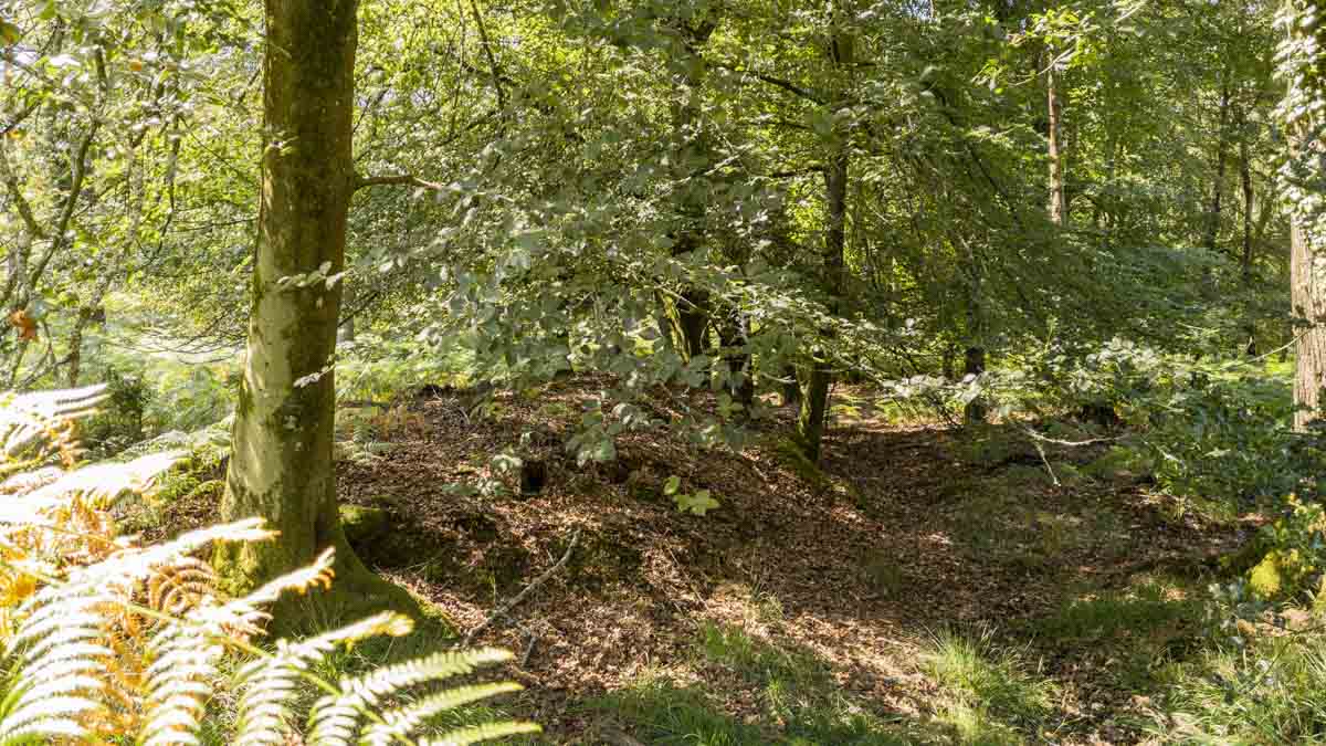
A park pale was traditionally a boundary used to enclose a deer park or managed area of woodland. It often consisted of an earth bank and ditch, sometimes topped with a wooden fence or paling, designed to control the movement of deer and mark the edge of the enclosed land. Centuries later, the timber has usually disappeared, leaving the surviving bank and ditch as a much subtler earthwork running through the landscape. That helped explain why the feature could appear clearly enough on an OS map yet be surprisingly difficult to pick out among the trees. Once I had seen a more obvious section for myself, though, the markings on the map suddenly made a lot more sense.
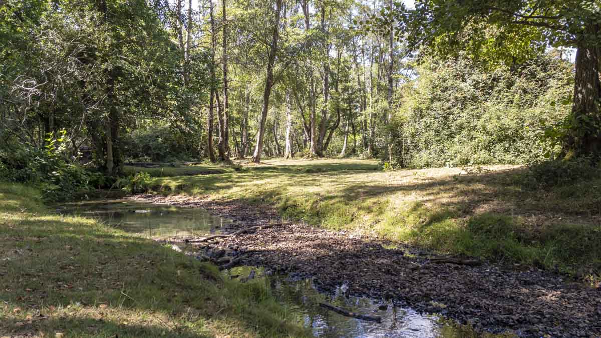
Around Holmhill Passage, the route drops very gradually toward a small stream before climbing again. Neither the descent nor ascent is difficult, but the water provided another change of atmosphere. It was here that I found one of my favourite moments of the whole walk. Rather than immediately carrying on, I sat for a while and simply listened to the forest. There are times when the memorable part of a walk is not a summit, viewpoint or landmark; sometimes it is just finding a quiet spot where there is no particular reason to hurry.
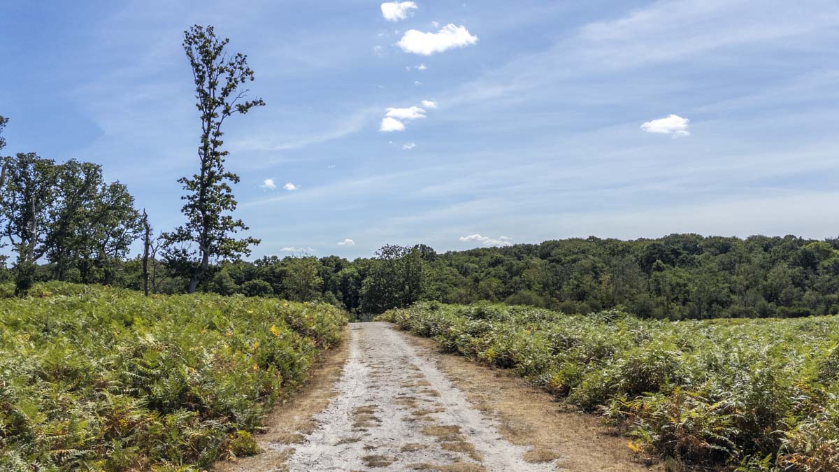
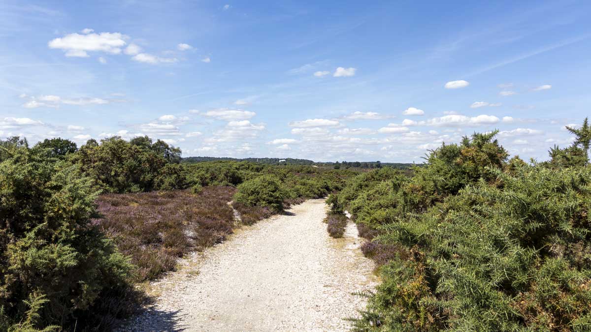
From there, the route continued curving back toward Lyndhurst and eventually returned to the open heath. The final section across White Moor was probably my favourite part of the route. Sandy paths ran between tall stands of gorse, and after spending so much time beneath the tree canopy, stepping back into the open landscape felt all the more striking. Some sections of sand were surprisingly deep, enough that decent footwear was useful even though the conditions were extremely dry.
The second encounter with White Moor also gave the route a satisfying sense of symmetry. The walk had started with that open New Forest vista, disappeared into woodland for much of its middle section and then returned to the heath before the finish. By then I had one eye on the parking time and needed to push the pace slightly, which rather spoiled the temptation to linger. Next time, I would give myself a larger margin and make more of that final section.
Navigation & Tech in the Field
Navigation was almost entirely handled through the OS Maps app. The published route was already available in the app, so after bookmarking and downloading it beforehand there was very little else to do. Positioning remained accurate with very little noticeable deviation, including through the more heavily wooded sections, which made following the route reassuringly straightforward.
I had the laminated A4 map and compass with me, but neither was needed beyond their role as backups. The main inconvenience was simply one that comes with navigating by phone: each time I wanted to check the route, I had to take the phone out, wake the screen and look at my position. Dedicated handheld GPS devices with permanently visible displays can make those quick checks slightly more convenient.
The newer phone did, however, give me far more confidence in battery life than I had experienced on some previous walks. I cannot remember the exact percentage used, but by the end of the route I was still confident there was enough power available for another walk later in the day. For me, that matters more than chasing precise battery statistics: I could use the map when I wanted it without constantly wondering whether I should be conserving power.
Skills & Takeaways
The most obvious thing I learned was simple: I now know what a Park Pale looks like. That may sound like a small takeaway, but it is exactly the sort of detail I enjoy picking up from these walks. Beforehand it was a label on a map and something I had seen in photographs; afterwards, it had become a physical feature I had actually searched for and recognised in the landscape.
More broadly, the walk added another small section to my understanding of the New Forest. Preparing the paper map had drawn my attention to something I might otherwise have walked straight past, and then finding it on the ground gave that piece of mapping a meaning it had not had before. It was a good example of how studying a route beforehand can turn an otherwise ordinary feature into part of the exploration itself.
If I repeated the walk, I would not change very much. I might deliberately allow more time for a longer stop somewhere in the forest and leave enough parking time that the final stretch across White Moor could be enjoyed at the same relaxed pace as the rest of the route.
Route Verdict
I really enjoyed this route. Its strength is the mixture of environments it manages to fit into a relatively straightforward New Forest walk. There are open views across White Moor, long woodland tracks, changing forest character, sandy heathland paths and small details such as the stream near Holmhill Passage and the Park Pale hidden among the trees.
White Moor was the highlight. The openness of the landscape made a strong impression at the beginning, and returning to it near the end gave the route an even better finish. If I walked this route again, the one change I would consider would be adding some extra exploration across the moor.
It should suit a wide range of walkers, including families, groups and those looking for an enjoyable afternoon in the New Forest. A moderate level of fitness is still useful simply because of the overall distance, while the deeper sandy sections make sensible footwear worthwhile.
Another advantage is its proximity to Lyndhurst. Once the walk is finished, the town is close enough to make lunch or a drink an easy addition to the day. For me, though, the strongest reason to walk it is the landscape itself. This is a varied New Forest route that moves naturally between open heath and atmospheric woodland, with White Moor providing the standout views. Easy access from Lyndhurst makes it a straightforward exploration, but searching for and eventually recognising the Park Pale gave this particular walk its own small thread of discovery.
0 Comments