Route Discovery
Dunstable Downs was the second walk of a trip into the north-east corner of the Chilterns, following on from Pegstone Hills earlier in the day. It was the second walk in this part of the Short Walks Made Easy Chilterns series.
I had never visited Dunstable Downs before and knew very little about the area. That was really part of the appeal. The walk offered another chance to explore a small piece of the Chilterns without too many preconceptions about what I would find. There were two things I did have in mind beforehand: another trig pillar, Dunstable Down TP0379, which sits close to the entrance to the car park, and simply the prospect of seeing what sort of views the Downs might offer.
Preparation & Route Planning
Although the route came from the Chilterns guidebook, I still spent a reasonable amount of time studying it beforehand. As with the Pegstone Hills walk, I recreated the route myself in the OS Maps app, transferring it from the guidebook into the web app. Plotting the route meant looking more closely at the rights of way, the types of paths involved and the elevation profile rather than simply turning up and following the book. It also gave me an opportunity to locate the trig pillar in advance.
I made no changes to the published route. Once plotted, the saved route was opened in the OS Maps app on my phone, with a local copy of the mapping downloaded for offline use. The walk was planned as a circular route from the Dunstable Downs National Trust car park, which I had pinned in Google Maps before travelling. The car park also made locating the trig pillar fairly straightforward, as I already knew it should be close to the entrance.
Recent weather had been consistently good, so I hadn't felt much need to check the forecast separately. I expected predominantly dry downland tracks and woodland paths, with the main attraction likely to be the escarpment and the views from the Icknield Way section. Beyond that, I was happy not to know too much. Part of the point was to see what the rest of the route had to offer.
Trail Notes
The car park sits at the top of the Downs, but rather than immediately heading out across the open escarpment, the route initially turns south. In doing so, it holds back what would eventually become its strongest section until much later in the walk. From the car park there is really only one marked footpath to follow, beginning on asphalt before the surface gives way to the softer forest floor of the Chiltern Way.
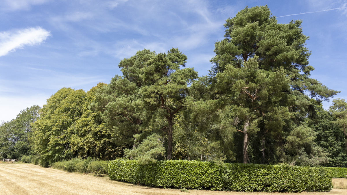
The wooded section is short, perhaps around 300 metres, before the route emerges onto a wider lane and makes a small detour through the grass meadow of Swallowsprings Nature Reserve. From there it leads to one of the most interesting surprises of the walk: the National Trust Whipsnade Tree Cathedral. Trees, hedges and shrubs have been planted to form the layout of a cathedral, making it somewhere worth stopping rather than simply passing through. I spent a little time exploring it, although in hindsight I wish I had stayed longer. It became one of the unexpected highlights of the route.
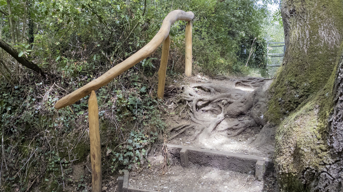
Leaving the Tree Cathedral, the route continues through grass meadow before eventually meeting the Icknield Way Trail. The character changes again here as the path narrows and works its way through a small cutting, contrasting with the wider grassland crossed earlier. One small detail that stood out was an impressive hand-carved handrail alongside part of the path. It was not the sort of feature I had set out expecting to find, but these little details give the route some of its individuality.
Most of the walk remains on higher ground, so there is very little sustained climbing. The main change comes as the Icknield Way reaches the Downs, where there is a short descent followed by a gentle climb back up. This was also the only point where navigation required a little extra care. Several paths converge at an intersection and, with tall grass obscuring some of their lines, it wasn't immediately obvious where each one went. A quick check of my position in OS Maps was enough to confirm the route.
Then the landscape suddenly opens. After the narrower Icknield Way section, reaching the top of the Downs reveals a broad 180-degree panorama towards the north-west. This was the view I had hoped the route would eventually deliver, and it didn't disappoint. The trail follows the top of the Downs towards the visitor centre and car park, with the escarpment giving the final part of the walk a much greater sense of space than the earlier woodland and meadow sections.
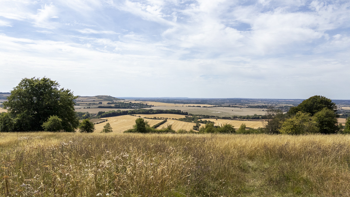
Conditions were exceptionally dry, with mostly level grass paths underfoot. Some parts of the Downs were a little uneven, but nothing particularly difficult in a decent pair of walking shoes. About halfway across I stopped for a while simply to look out over the landscape. There was no particular landmark I was trying to identify and no navigation problem to solve; it was simply a place where it felt natural to pause and take in the view. The bright, clear day helped, with excellent visibility allowing the Downs to provide exactly the sort of wide panorama I had been hoping for. The route had saved its best until last, with the escarpment and open views providing a strong finish as the Icknield Way carried me back towards the car park.
Skills & Takeaways
There were no major navigation or equipment lessons to take away from this walk. If anything, it reinforced that the planning approach I had already been using worked perfectly well: recreate the published route in OS Maps, study the terrain beforehand, and then use the saved route in the field.
The more useful takeaway was geographical. Before arriving, Dunstable Downs had effectively been another name on the map. Walking the circuit added some detail to that blank space; woodland, grass meadows, the Icknield Way, the open escarpment and the landscape spreading away below it. The distance, terrain and amount of ascent all felt much as expected, and there is nothing I would particularly change if walking the same route again.
Route Verdict
This turned out to be a good, varied circuit. The panoramic views from Dunstable Downs are its strongest reason for being walked, but the route isn't simply a means of reaching the escarpment. The woodland paths, grass meadows, Swallowsprings Nature Reserve and particularly the Whipsnade Tree Cathedral give the earlier part of the walk enough variety and interest of its own. While I had expected the views to be the obvious highlight, the Tree Cathedral was probably the most interesting surprise, and if I repeated the route I would be tempted to spend a little longer exploring there.
The route is straightforward to follow and should suit most walkers. Beginners and less-experienced walkers should find it approachable, while the open spaces and places to stop make it suitable for families wanting to take their time or have a picnic along the way. The published guidebook alone would be sufficient for navigation, although some extra care is worthwhile where the paths converge around the Icknield Way and the Downs.
In dry summer conditions the walking was easy. During wetter periods I would expect parts of the Icknield Way, particularly as it winds through the cutting, to become considerably muddier, but not enough for me to rule out the route altogether. Would I rush back to walk it again? Probably not, but that doesn't stop it being an easy route to recommend to somebody who hasn't been here before.
For me, its character comes from the way it builds towards the Downs. The smaller features along the way add interest before the landscape finally opens and the panoramic views take over.
0 Comments