A GPS receiver can show your position almost anywhere in the landscape, often to within a few metres. It can place you on a map, give you a grid reference and guide you towards a waypoint, all without needing a mobile signal or sending your location to a satellite.
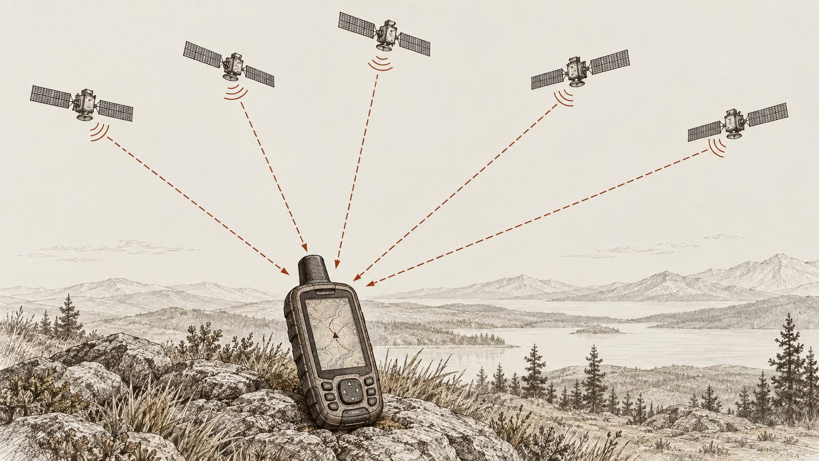
The process begins with a network of satellites orbiting high above the Earth. Each satellite continually broadcasts a radio signal containing precise timing information and details about its position in orbit. Your GPS receiver listens for those signals and uses them as a set of reference points from which to calculate its own position.
The satellites are not tracking the receiver, and they do not send it a ready-made location. Instead, the receiver works out where it is by measuring how long several satellite signals took to reach it and combining those measurements into a position
How Your GPS Uses Satellites
Every GPS satellite carries extremely accurate clocks and follows an orbit that can be predicted with great precision. As it travels around the Earth, it continually transmits a signal containing the time at which that signal was sent, together with information that allows a receiver to determine where the satellite was at that moment.
A GPS receiver compares the transmission time encoded in the signal with the moment that signal arrives. Because radio signals travel at approximately the speed of light, even a very small delay represents a considerable distance. By measuring that delay, the receiver can estimate how far away the satellite is.
One satellite therefore gives the receiver two important pieces of information: the satellite's position in space and an estimate of the distance between the satellite and the receiver.
What it does not provide is the receiver's location.
Knowing that you are a certain distance from one satellite still leaves an enormous number of possible positions. The receiver needs measurements from several satellites before it can narrow those possibilities down and calculate where it is.
Turning Signals Into a Position
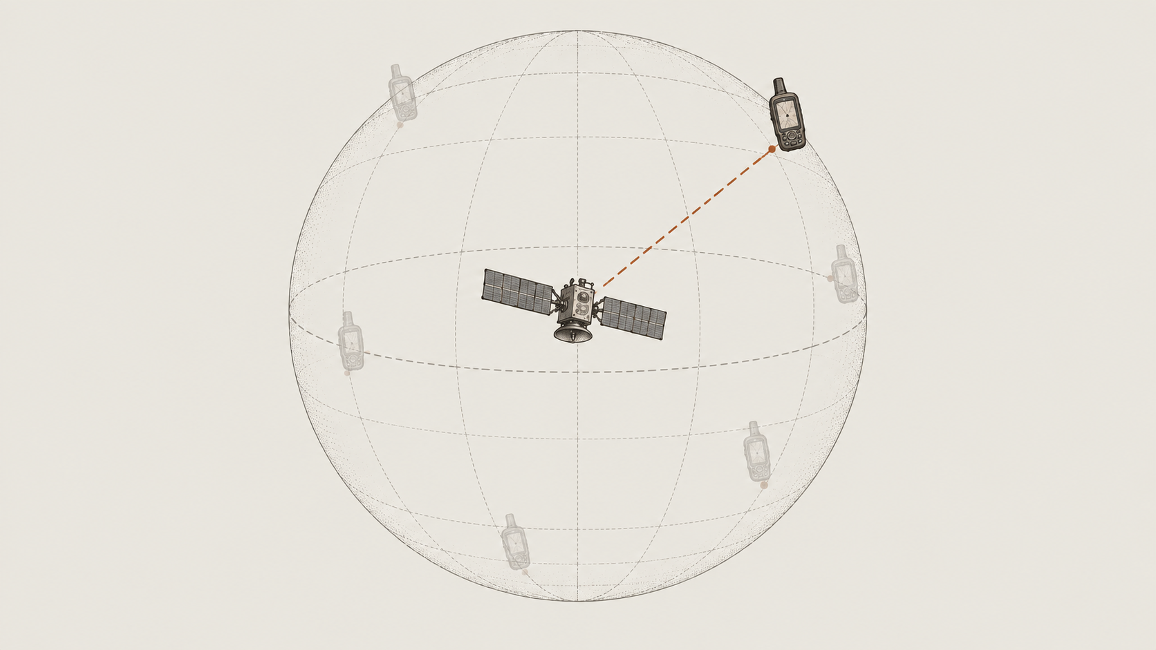
A useful way to understand the process is to think of each distance measurement as creating a boundary around a satellite.
If a receiver determines that it is a particular distance from one satellite, it could theoretically be anywhere at that distance. In three dimensions, those possible locations form an imaginary sphere around the satellite.
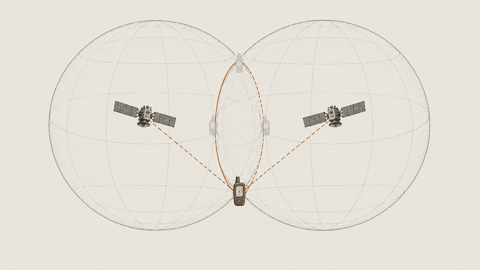
A second satellite provides another distance measurement and therefore another possible sphere. The receiver must now be somewhere that satisfies both measurements, so the possible locations are restricted to the area where the two spheres intersect.
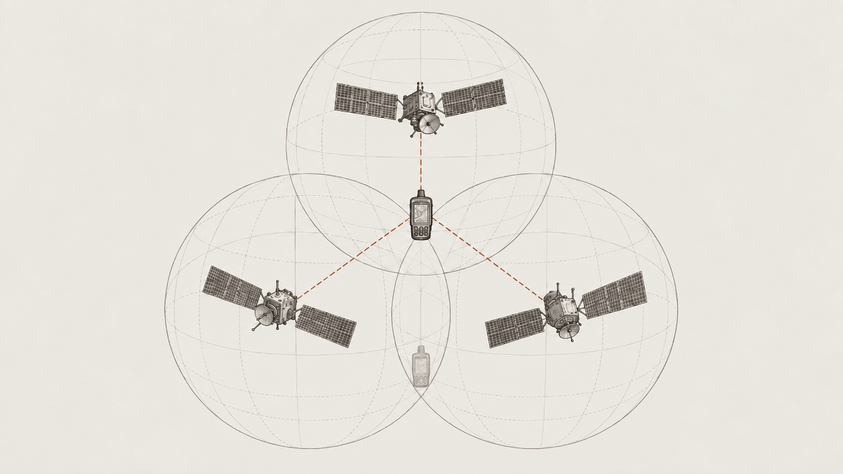
A third satellite narrows the possibilities further. By combining several measurements from satellites at different positions in the sky, the receiver can progressively reduce the number of possible locations until it can calculate a position close to the surface of the Earth.
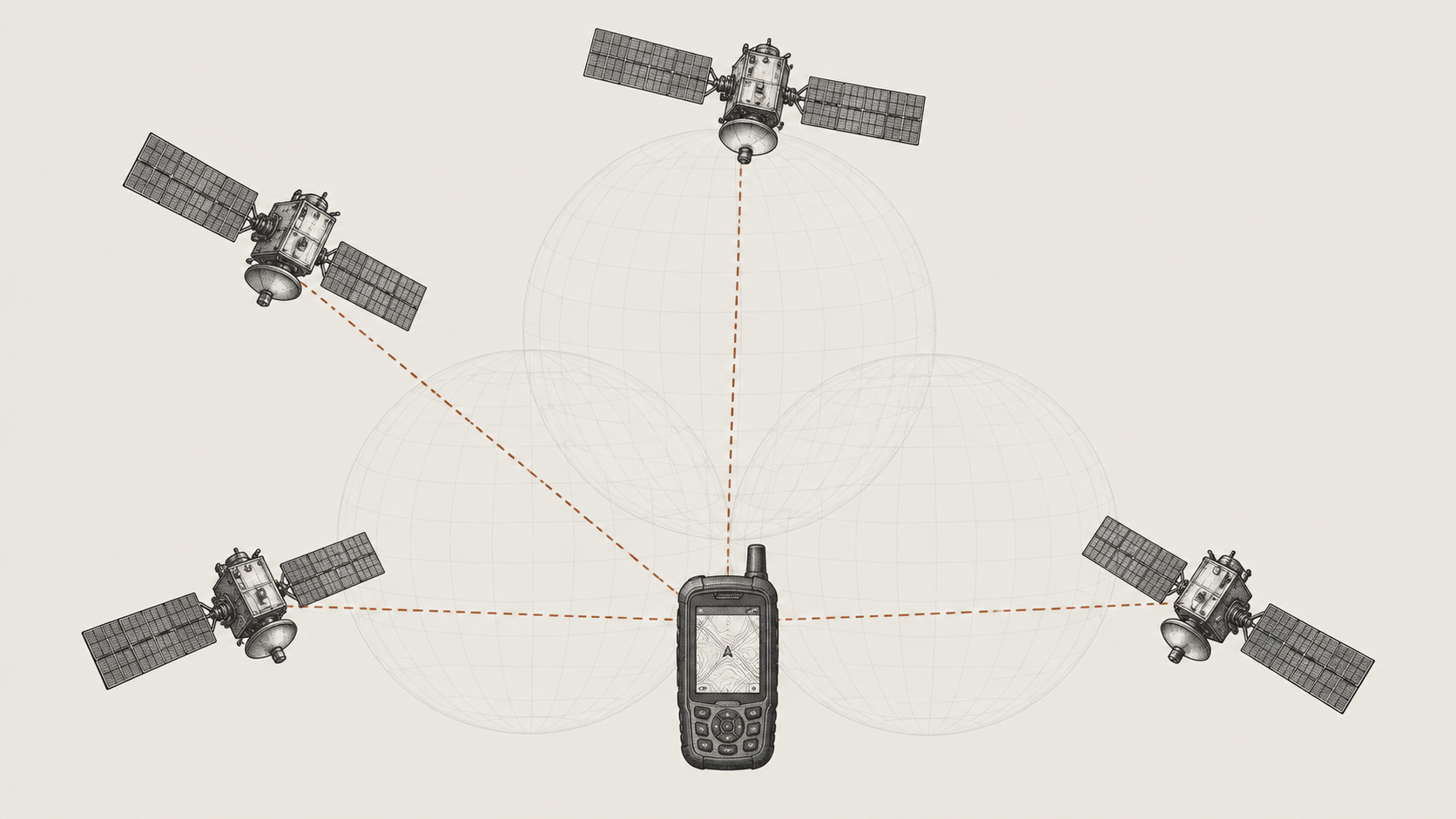
There is another complication. The clocks aboard GPS satellites are extraordinarily accurate, but the clock inside a handheld receiver is not. Even a tiny error in the receiver's timing would translate into a large error in the calculated distance because the signals are travelling so quickly.
The receiver therefore has to determine its own clock error at the same time as it calculates its position. In practice, this means it normally needs signals from at least four satellites to solve for its three-dimensional position and correct for the error in its internal clock.
This is why a GPS receiver does more than simply measure its distance from a few points in the sky. It is continually solving several measurements together, using the known positions of the satellites, the travel time of their signals and a correction for its own timing.
The position of those satellites in the sky also has some influence on the result. Measurements from satellites spread across different parts of the sky generally provide a stronger basis for calculating a position than measurements from satellites clustered in a similar direction. This is known as satellite geometry, but for normal GPS use the important point is simply that the receiver benefits not only from seeing several satellites, but from seeing them across a useful spread of the sky.
From a Position to a Place on the Map
The position calculated from the satellite signals does not begin as a British National Grid reference or as the latitude and longitude shown on the screen.
Internally, the receiver first determines its position relative to a mathematical model of the Earth. It can then express that same physical position using the coordinate system and position format selected on the device.
A receiver might therefore show a location as latitude and longitude, while another device at exactly the same spot could show it as a British National Grid reference. The coordinates look very different, but they are describing the same place.
This distinction is useful because the satellites themselves are not broadcasting map coordinates for your location. They provide the timing and orbital information needed for the receiver to calculate a position. The receiver then converts that result into a form that is useful to you.
Once that position has been calculated, it can also be placed on a digital map, compared with a saved waypoint or recorded as part of a track. The familiar position marker on the screen is therefore the final stage of a much larger calculation taking place in the background.
When the Landscape Gets in the Way
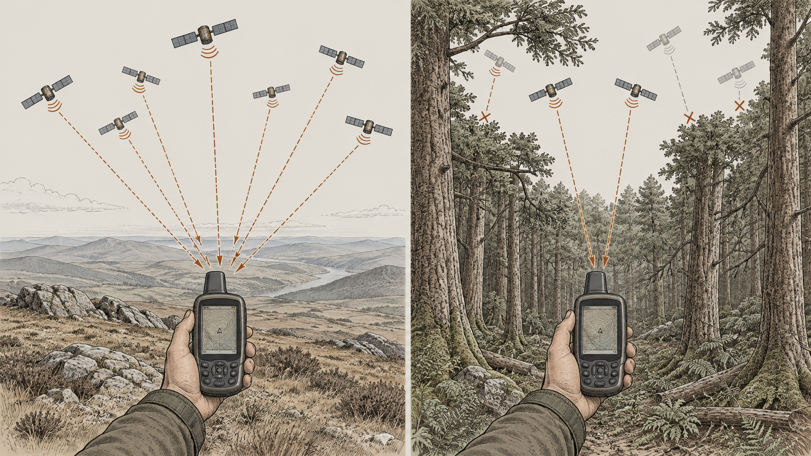
The basic process works best when the receiver has a clear view of a large portion of the sky. In an open landscape, signals from satellites in many different directions may be able to reach the receiver directly.
The situation changes when parts of the sky become obstructed. Trees and foliage can weaken or scatter satellite signals, while steep slopes, cliffs and buildings can prevent the receiver from receiving signals from some directions altogether. A receiver in a narrow valley or beside a high rock face may therefore be working with a much more restricted view of the sky than one standing on an open hilltop.
Signals can also reach the receiver indirectly. Instead of travelling straight from the satellite, a signal may reflect from a building, rock face or other surface before arriving at the device.
Because the reflected signal has travelled farther than the direct path between the satellite and the receiver, its travel time is slightly longer. If that additional delay influences the measurement, the receiver may calculate the satellite as being farther away than it really is, shifting the resulting position.
The receiver is continually dealing with small variations such as these while combining measurements from several satellites. This is why the position shown by a GPS device should be understood as a calculated estimate rather than an exact observation of a fixed point on the ground.
An Example from the Field
The difference becomes easier to understand when comparing two very different locations.
On an open hilltop, a GPS receiver may have an unobstructed view across much of the sky. Signals can arrive from satellites in several different directions, giving the receiver a good set of measurements from which to calculate its position.
Move the same receiver beneath dense woodland or into more enclosed terrain and the situation can change. Some satellite signals may be weakened by the tree canopy, others may be blocked completely, and reflected signals may introduce additional uncertainty into the measurements.
The receiver has not changed, and the underlying method used to calculate its position is exactly the same. What has changed is the set of satellite signals available to it and the conditions those signals have passed through before reaching the device.
This can affect how quickly the receiver settles on a position, the accuracy estimate displayed on the screen and how stable that calculated position remains over time.
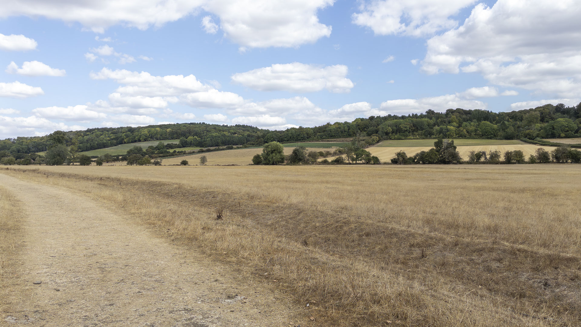
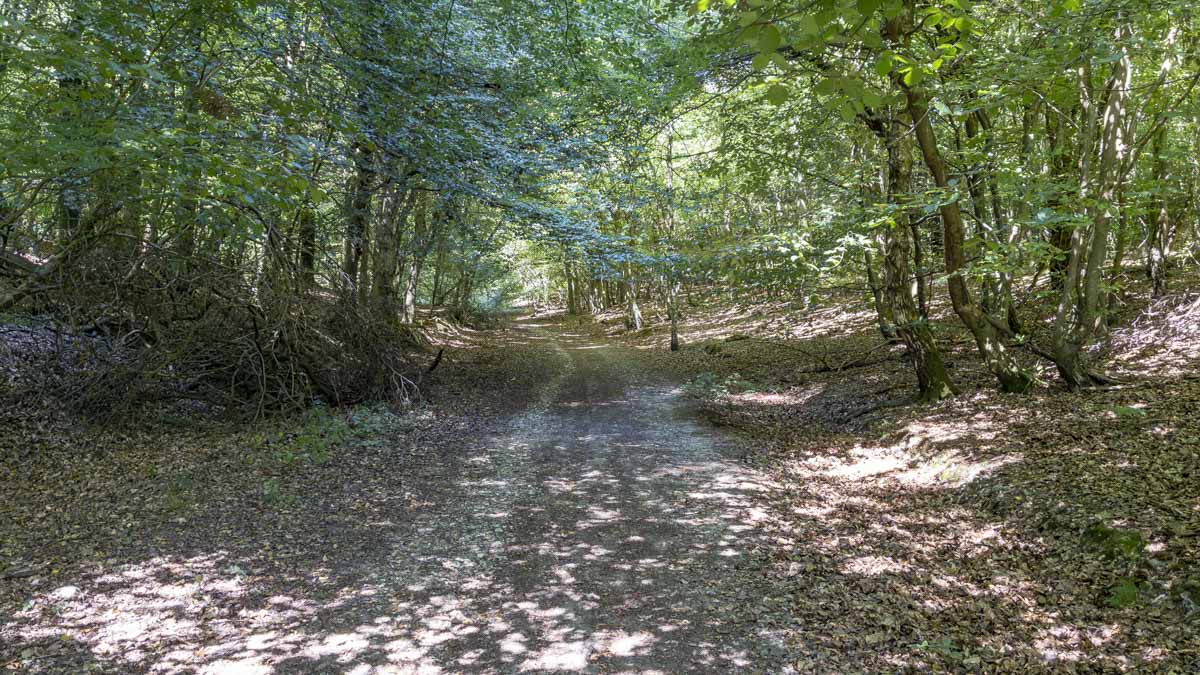
These two environments give a GPS receiver very different views of the sky, even before any measurements are calculated.
Applying this on a Walk
A GPS receiver can make finding your position feel almost instantaneous, but the point displayed on the screen is the result of a continuous series of measurements and calculations.
The satellites provide known reference points and extremely precise timing information. The receiver measures how long their signals took to arrive, estimates its distance from several satellites and combines those distances to calculate its position. It then converts that position into the coordinate format and map display you see on the device.
Understanding that process helps explain why the conditions around you matter. An open view of the sky generally gives the receiver access to a better range of satellite signals, while woodland, steep terrain and buildings can make the calculation more difficult. It also explains why a GPS position is never completely fixed: each result is an estimate based on the measurements available at that particular moment.
When you look at the position marker on a GPS device, you are therefore not seeing a location sent down from a satellite. You are seeing the receiver's own solution to a positioning problem, calculated from signals arriving from thousands of kilometres above the landscape.