A grid reference is more than just a series of numbers on a map. It represents a fixed position somewhere in the landscape — a point that exists whether we can see it or not. But how accurately can a handheld GNSS device take us from that digital location to the real-world feature?
For this field test, I set out to answer that question by navigating to a known trig point using a Garmin eTrex SE. Starting with a published grid reference, I entered the location into the device and followed its guidance to see how closely the calculated position matched the physical feature on the ground.
Trig points provide an ideal test location. Their positions are precisely recorded, they are fixed features that have remained in place for decades, and they provide a clear reference point for comparing the information shown on a screen with what is actually found in the landscape.
The aim was not simply to see whether the eTrex SE could "find" a trig point, but to better understand the relationship between a grid reference, GNSS accuracy, and our position in the real world.
In This Field Test
In This Field Test
Test Overview and Method
The aim of this field test was to assess how accurately a handheld GNSS device could navigate to a known location using a published grid reference.
A trig point was selected as the test location because it provides a fixed and precisely recorded feature in the landscape. By using the published position of the trig point as the destination, it was possible to compare the digital coordinate entered into the Garmin eTrex SE with the physical location found on the ground.
The test followed the complete navigation process:
- obtaining a published 10-figure British National Grid reference
- entering the coordinate into the Garmin eTrex SE as a waypoint
- navigating directly to the location using the device
- comparing the calculated position with the actual trig point location
The purpose was not to determine whether the eTrex SE could provide a perfect one-metre position, but to better understand the relationship between grid reference precision, GNSS accuracy, and the real-world location of a feature.
Selecting the Trig Point
The trig point selected for this field test was Sway TP6280, which formed part of a walking route I was already planning for the day. It provided a suitable location for testing GNSS accuracy as it was accessible, surrounded by relatively open ground, and had a clear view of the sky.
Although the surrounding area contained some gorse bushes, there were no significant overhead obstructions such as trees or buildings that could limit satellite visibility. This helped reduce external factors that could influence the GNSS signal during the test.
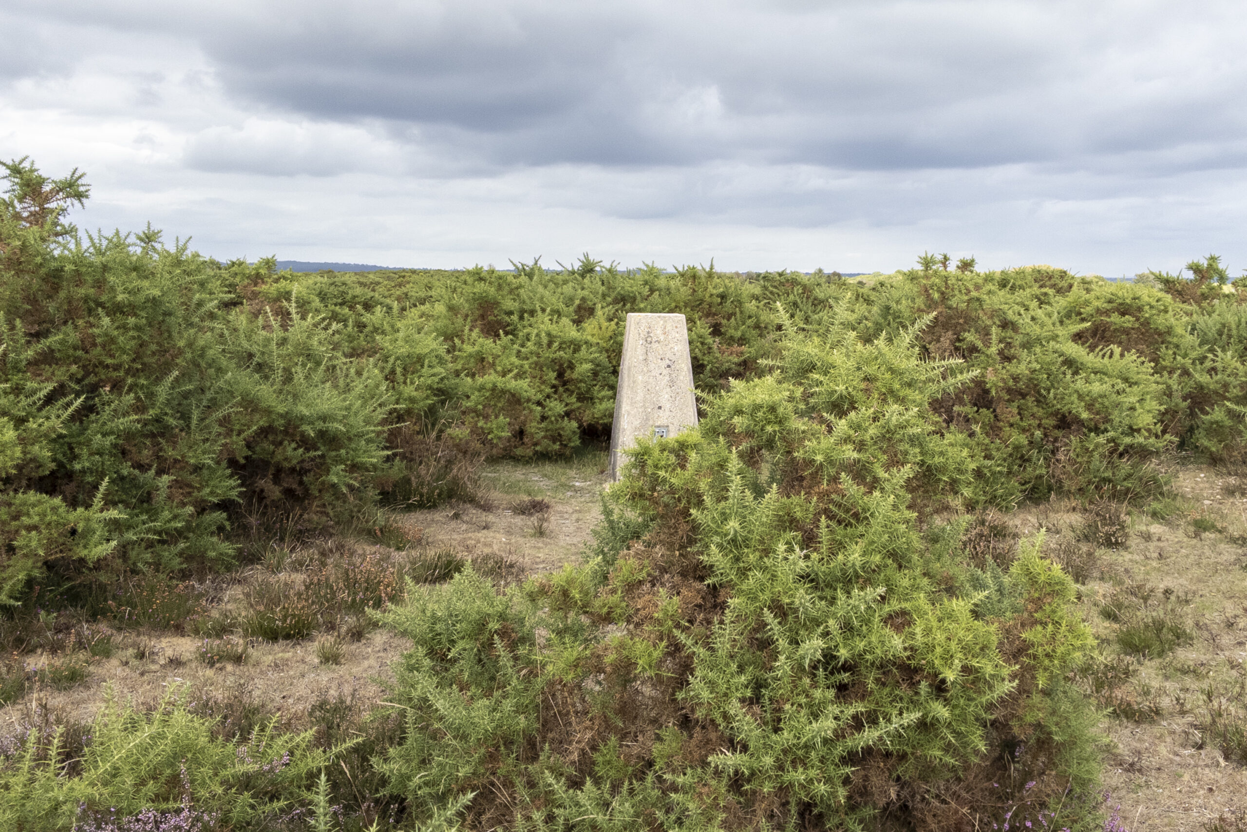
The Sway TP6280 trig point surrounded by tall gorse, showing how the feature was not immediately obvious when approaching on foot.
Obtaining the Grid Reference
The published location of the trig point was obtained from the Trigpointing UK listing page and cross-referenced against the Ordnance Survey trig point archive. For the test, I used the published 10-figure British National Grid reference:
SZ 27936 99816
A 10-figure grid reference represents a 1 m × 1 m square, providing the highest level of precision commonly used for outdoor navigation.
It is important to understand that coordinate precision and GNSS accuracy are two different things. Coordinate precision describes how precisely a location is written down, for example a 10-figure grid reference identifying a 1 m x 1 m square on the map. GNSS accuracy describes how close the receiver’s calculated position is to the true location on the ground. The grid reference defines the location being navigated to, while the GNSS receiver calculates its own position based on satellite signals and environmental conditions.
Creating the Waypoint
The 10-figure grid reference was manually entered into the Garmin eTrex SE and saved as a waypoint. The waypoint was renamed to identify the target trig point location and indicate that it was created from the published 10-figure grid reference.
The eTrex SE was then set to navigate directly to this waypoint.
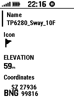
The Garmin eTrex SE waypoint created from the published 10-figure grid reference.
Navigating to the Trig Point
At this point, the trig point itself was not immediately obvious within the landscape. The surrounding gorse was approximately 5 ft high, while the trig pillar itself stands at around 4 ft, meaning the feature was partially hidden despite being close to the calculated location. The final approach was completed using the compass navigation screen on the eTrex SE. The device was followed until it indicated that the destination had been reached.
Results
The Garmin eTrex SE successfully navigated to the entered waypoint location using the published 10-figure grid reference for Sway TP6280. During the approach, the device was used with the compass screen displaying distance to destination and GNSS accuracy. On arrival at the waypoint, the eTrex SE indicated that the destination had been reached.
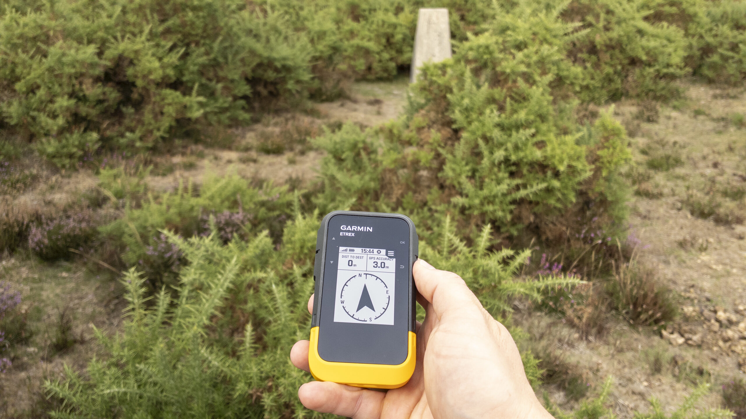
The Garmin eTrex SE showing arrival at the waypoint, with the trig point visible through the surrounding gorse.
The trig point was visible a short distance away from the indicated waypoint location. I moved to the physical trig point and placed the eTrex SE directly on top of the pillar. After allowing the device time to obtain a stable position fix, I recorded the position shown by the device:
SZ 27940 99823
The compass screen displayed a distance of approximately 8 metres between the current position and the original waypoint location. At the time of recording, the eTrex SE reported an estimated GNSS accuracy of approximately 3 metres.
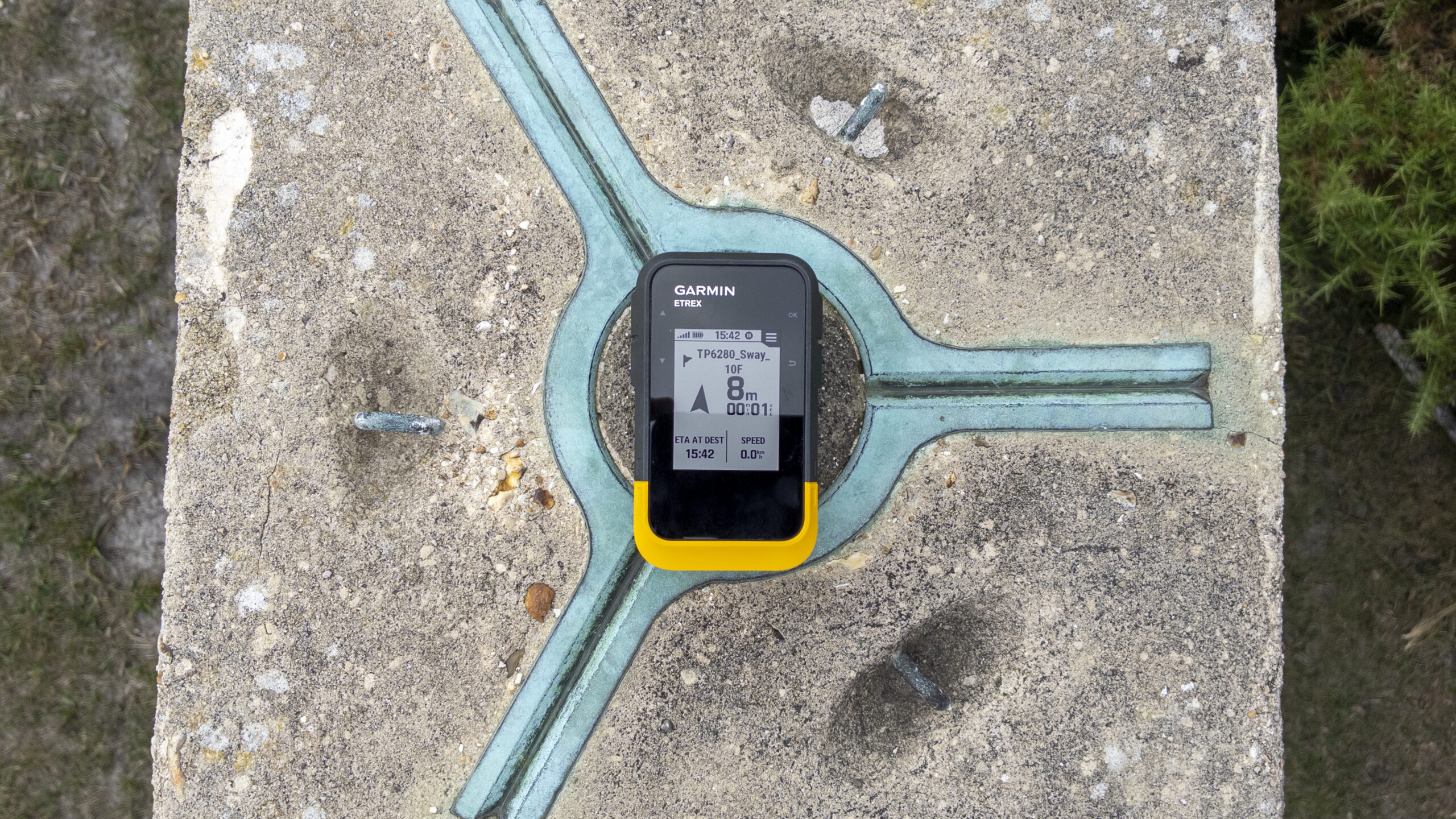
Test Results Summary
| Field | Details |
|---|---|
| Device | Garmin eTrex SE |
| Feature tested | Sway TP6280 trig point |
| Published grid reference entered | SZ 27936 99816 |
| Recorded GNSS position | SZ 27940 99823 |
| GNSS accuracy displayed | Approx. 3 metres |
| Distance from waypoint | Approx. 8 metres |
What This Shows
The purpose of this test was not simply to see whether the eTrex SE could "find" a trig point, but to better understand the relationship between a grid reference, GNSS accuracy, and our position in the real world.
The results show that a GNSS device can be an extremely effective tool for locating fixed features in the landscape. Using only a published grid reference, the eTrex SE guided me to within a few metres of the Sway trig point, with the physical feature visible close to the indicated waypoint location.
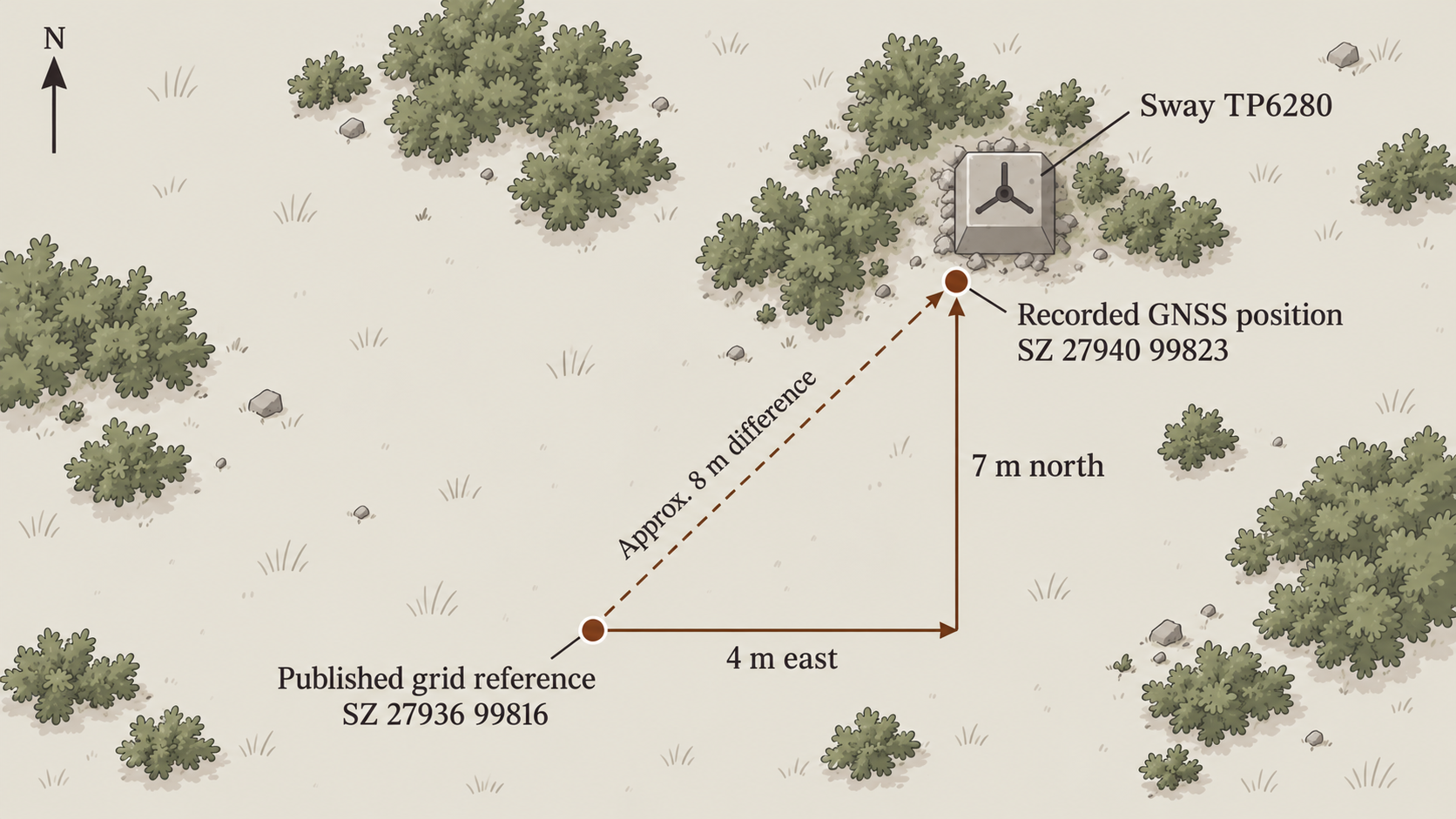
Comparison between the published trig point position and the GNSS position recorded at Sway TP6280, showing the small difference between the mapped location and the position calculated in the field.
In this case, the GNSS device provided a significant advantage. Although the trig point was only a short distance away, the surrounding gorse was tall enough that the pillar was not immediately obvious within the landscape. Without the device guiding me to the correct area, locating the trig point could have taken considerably longer, particularly when relying only on visual searching.
However, the test also demonstrates that a precise grid reference does not guarantee a position accurate to the same level. The published location of the trig point was not incorrect, and the eTrex SE was not simply "wrong". Instead, the difference between the two positions reflects the reality of using GNSS outdoors: the coordinate represents a known location, while the device calculates its own position based on satellite signals and environmental conditions.
In this case, the recorded position was approximately 8 metres from the published grid reference, with the difference being 4 metres east and 7 metres north. For practical navigation, this level of accuracy is more than sufficient to locate a feature such as a trig point, while also highlighting why understanding GNSS accuracy remains an important part of using these devices effectively.
This field test showed that a GNSS device is a powerful tool for locating fixed features in the landscape. While the coordinate recorded by the eTrex SE was not identical to the published trig point position, the difference was small enough to guide me directly to the feature. In this case, the device transformed a hidden trig point surrounded by gorse into an easy-to-locate destination.